17 August 2011 0745-1450 Baddeck to St Peter's Marina, Cape Breton Island, Nova Scotia 29nm
Enroute to Baddeck we had a problem associated with the port alternator. We anchored so Ted could put the spare alternator on. No joy. Shut down the port engine and continued on. Did I mention before that the Lions Club owns the marina in St Peter's? Its a very nice marina; separate bathroom/showers for boaters. I did discover that only the handicapped bathroom has an electrical outlet (to dry your hair!) On our first pass through St Peter's we went to a pizza joint and tried the "local"
donair sauce and donair meat on the pizza. Donair sauce is a combination of condensed milk and white vinegar. Sweet but acidic. Not good enough to try again but very popular in this part of Nova Scotia.
18 August 2011 0821-1245 St Peter's to Cape Canso, NS 28nm
As we headed to the lock we had to pass under this bridge. Ted decided that we didn't need it open. The bridge tender wasn't convinced. He stopped traffic and was all ready to open it just in case we were wrong.
 |
| Bridge - St Peter's lock |
This time we had the lock to ourselves....
 |
| St Peter's Lock - Cape Breton, Nova Scotia |
About 2 hours out of St Peter's we discovered that the 2 refrigerators were totally defrosted - not good! We diverted into Cape Canso to troubleshoot the problem.
 |
| Town of Canso |
Turns out we stayed in the Cape Canso RV Park & Marina. Canso is a very small town. Located on the eastern tip of Nova Scotia, Canso is a historic fishing village.
Ted discovered that our refrigerators would run on neither AC or DC power. I now have "iceboxes". The local folks ran us up to buy ice for the iceboxes.
19 August 2011 0905-1559 Cape Canso to Port Bickerton, NS 43nm
Continuing down the Nova Scotia coast, we stopped in Port Bickerton overnight. You can see Canso on the eastern tip in the google map below and Port Bickerton farther south west.
View Larger Map
Port Bickerton is home to a small contingent of the Canadian Coast Guard. They were moored on one side of the wharf and we were on the other side.
 |
| Wharf - Port Bickerton |
We moored on the right hand side of the wharf; the CCG ships are on the other side. No ice to be had in Port Bickerton.
20 August 2011 0746-1459 Port Bickerton to Tangier, NS 52nm
Beautiful Nova Scotia coastline....
View Larger Map
We pulled into Tangier Harbor and moored for the night. The harbor master for the Port Authority came down to check us out and wound up running Ted to a small Sears appliance store 30 minutes away. Ted purchased a 5 cubic foot freezer. Now we can make our own ice! Tangier has a population of about 1000 people. Kayaking brings tourists to the area. Canada's best
smoked salmon also comes from the area.
 |
| Tangier Sunset |
21 August 2011 0759-1504 Tangier to Halifax, NS 49nm
From Tangier we cruised down to Halifax and moored right in downtown Halifax at Bishops Landing. Halifax is wide open to wind and sea from the Atlantic so most people moor in the Northeast Arm at the Royal Nova Scotia Yacht Squadron's facility.
View Larger Map
 |
| Halifax approach |
Diane & Steve Koch (M/Y Aurora, a Defever 49) recommended the inside slip at Bishops Landing. Bishop's Landing is an international award-winning development on the Halifax waterfront, comprising 206 residential suites, and 40,000 sq. ft. of retail and commercial space, including some of the city's best shops and restaurants.
View Larger Map
We were moored where the green arrow is.
22-26 August 2011 Moored Bishop Landing, Halifax, NS
Lots to see and do in Halifax; we spent the better part of a day at The Citadel. The present Citadel was completed in 1856 and is the fourth in a series of British forts on this site. Today, the restored Citadel is a national landmark, commemorating Halifax’s role as a key naval station in the British Empire and bringing history to life in Atlantic Canada’s largest urban centre.
 |
| The Citadel - Halifax, Nova Scotia |
 |
| Halifax Harbor |
 |
| Citadel guard, Nancy, Cathy |
 |
| Citadel bagpiper |
 |
| Citadel soldiers mustering |
 |
| Nancy, Mary Fitzgerald, Cathy Carson |
 |
| Harbor shuttle |
 |
| Ted and "Theodore Tug" |
Canadian Forces Base Halifax (CFB Halifax) is Canada's East Coast naval base and home port to the Atlantic Fleet. It is the largest military base in Canada in terms of the number of posted personnel.
 |
| Halifax street |
 |
| Halifax windvane |
A weather vane, with a compass, in the shape of the schooner 'The
Bluenose' on top of the World Trade Building in Halifax, Nova Scotia.
Mary & Jim Fitzgerald, who joined us in Charlottetown, PEI, disembarked in Halifax.
 |
| Mary & Jim Fitzgerald |
Jack & Cathy Carson from Poulsbo, WA joined us in Halifax. We all really enjoyed Halifax. Tried a lot of restaurants but the best one was right on front of us at Bishops Landing,
The Bicycle Thief.
We'd been watching Hurricane Irene's path trying to figure out if she was headed our way. Friends on
M/Y Patty Lou were already over at the
Royal Nova Scotia Yacht Squadron planning to sit out Irene there.
26 August 2011 1522-1639 Halifax to Royal Nova Scotia Yacht Squadron, Halifax, NS 4nm
We left downtown Halifax and headed over to RNSYS, pumped out and took a slip for the night. Our friends on M/Y Patty Lou, Don and Pat Pickworth, were already there. Did happy hour on their boat and listened to their tales - they have been doing the Down East Loop as well but running harder, longer and faster ahead of us. We first met Don & Pat way back in Quebec City. Every time we start to close the gap, they picked up the pace!
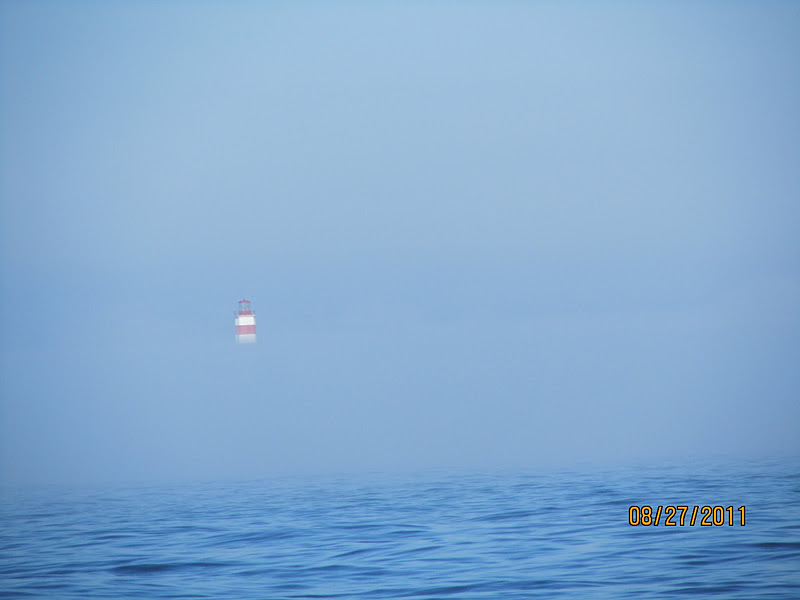
27 August 2011 0704-1323 RNSYS to Deep Cove (Mahone Bay), NS 43nm
 |
| Lighthouse shrouded in fog enroute to Mahone Bay |
In preparation for Hurricane Irene we headed over to a well known hurricane hole inside Mahone Bay.
Deep Cove is a skinny finger off Mahone Bay with trees on either side. We were practically the only boat in here for the hurricane.
View Larger Map
 |
| Deep Cove |
 |
| Sailboat moored in Deep Cove |
 |
| The view from our anchorage |
We are told that there used to be no condos and just trees in the photo above. It was hard finding some shallow water where we could drop the hook. We found a mere 26' and dropped the anchor.
28-29 August 2011 Anchored Deep Cove, NS
Irene turned out to be a non-event for us. Lots of wind and rain but she headed west and was well away from Nova Scotia. We read and played Mexican Train while we sat there.
 |
| Jack & Ted - I think they've won 2 times in a row |
The guys don't like to lose so we generally have to play until they clean our clocks. In this case I think they won the whole time.
Good night, Irene!
29 August 2011 1140-1407 Deep Cove to Mahone Harbor (Mahone Bay), NS 14nm
It was a short run over to Mahone Harbor where we tied up alongside a floating dock and checked out the town. Some of the sights....
 |
| Aquaculture - mooring balls for nets? |
 |
| Small town along the way |
 |
| More aquaculture ongoing |
 |
| Aloha Friday moored in Mahone Harbor |
 |
| Street scene - marinas are small |
 |
| Mahone Harbor |
 |
| Little houseboat and megayacht - Mahone Harbor |
 |
| Three churches - Mahone Harbor |
The view across the harbour of three prominent churches (St James
Anglican;
Lutheran; and
United) has become an iconic image of Nova Scotia, frequently photographed and featured on postcards and calendars.
 |
| Ted, Cathy, Jack - Dinner at the "Mug & Anchor" |
 |
| Sunset - Mahone Harbor |
 |
| Credit - Wikipedia |
A little perspective on where Mahone Bay is in Nova Scotia. We still have to head around the tip to Yarmouth to make our crossing to Maine.
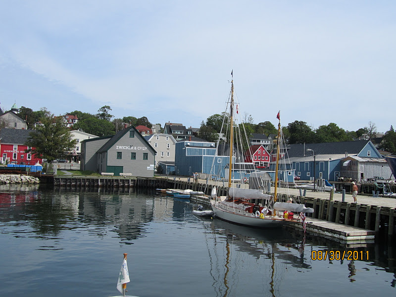
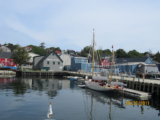
30 August 2011 0826-1118 Mahone Harbor to Lunenburg, NS 19nm
Everyone stops in Lunenburg. It is the most picturesque spot we've encountered outside of Quebec City.
 |
| Lunenburg | | | | | |
Lunenburg is a
UNESCO World Heritage site. With a population of just over 2,000 people, Lunenburg is mired in history. It was and still is, to some degree a seaport and shipbuilding center. The world famous schooner, Bluenose and Bluenose II were built in Lunenburg. The buildings in the town are very colorful - zoom in on the picture above to see.
 |
| Lunenburg waterfront |
 |
| Lunenburg - a working harbor |
 |
| Dock where we moored |
 |
| Nancy & Cathy - Bluenose construction site |
 |
| Rebuilding the Bluenose |
 |
| Lunenburg street |
 |
| Aloha Friday moored in Lunenburg - credits Cathy Carson |
31 August 2011 0838-1511 Lunenburg to Carter's Beach (Port Mouton), NS 44nm
Port Mouton (pronounced Ma-toon) was an overnight stop for us. The local harbor was full as you can see in the photos. We decided to anchor off the beach.
 |
| Port Mouton |
 |
| Port Mouton |
 |
| Anchored off Carter's Beach |
View Larger Map
There should be a green arrow pointing to where we were anchored off the beach.
1 September 2011 0754-1316 Port Mouton to Shelburne Yacht Club, NS 39nm
Take a look at the coastline as we head from Port Mouton to Shelburne.
View Larger Map
Some of the sights....
 |
| Interesting residence |
 |
| M/Y CARRY ON with flopper stoppers (stabilizers) deployed |
 |
| Shelburne historic buildings |
 |
| A view of ALOHA FRIDAY over the breakwater |
 |
| Dory Museum |
 |
| Holding the building up |
 |
| Planning the next day's route |
 |
| Shelburne Yacht Club |
2 September 2011 1057-1954 Shelburne to East Pubnico, NS 54nm
Leaving Shelburne we spotted pens that we assumed are associated with aquaculture.
We rounded Cape Sable, the southern most tip of Nova Scotia, and headed into East Pubnico to anchor. It was a little rougher than we expected at the Cape. Fortunately it did not last long!
View Larger Map
 |
| Lighthouse along the way |
 |
| Sunset in East Pubnico |
3-6 September 2011 0945-1300 East Pubnico to Yarmouth, NS 27nm
Yarmouth is our last port of call in Canada. It is located on the west side of Nova Scotia and makes for an easy overnight run to Maine. We wound up waiting a few days for a weather window while we were here. More time for sightseeing!
 |
| Yarmouth waterfront |
 |
| Low tide |
 |
| A Reenactment - creating a kilt from a blanket |
 |
| High tide at the marina |
 |
| Unloading a fresh catch |
 |
| High and dry |
 |
| Low tide at the marina |
 |
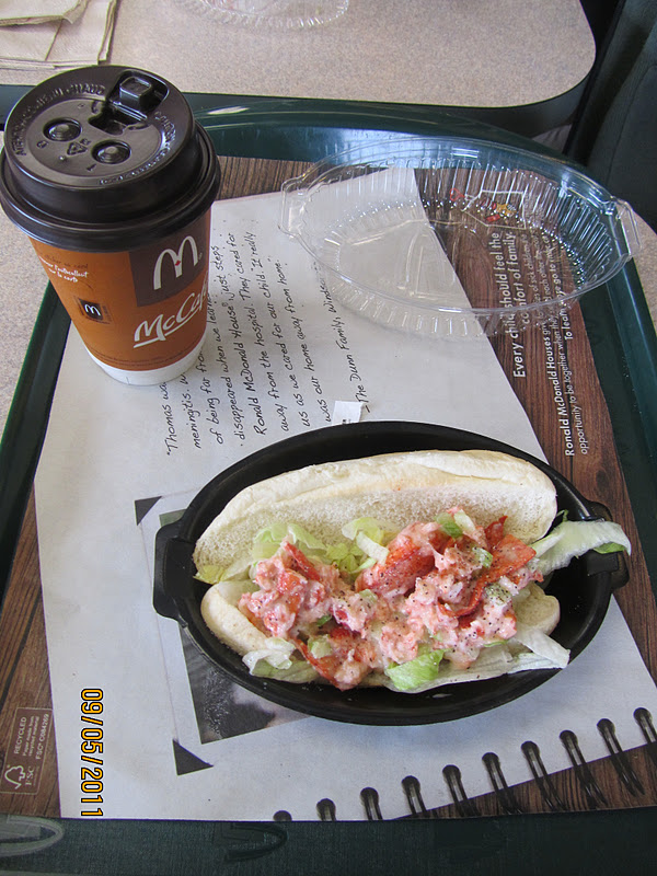
| McDonald's McLobster - Yummy! |
We departed Yarmouth at 10PM 6 September and had an uneventful crossing. 110 nm and 12 hours later we arrived in Maine.